
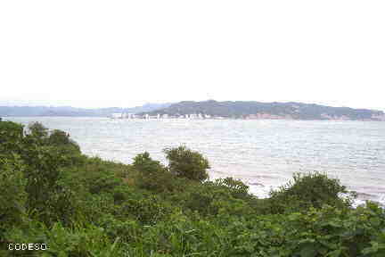
Bahía de Caráquez
Turismo en
Bahía de Caráquez
Turismo en
Bahía de Caráquez
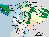
Bahía de Caráquez - Provincia Manabi
CI
Bahía de Caráquez has a beautiful beach.
It is reached by boat or by the bridge from San Vicente in the north of Portoviejo
Historic place:
This Historic Site maintains the traditional architecture with simple and formal forms from other times. Surrounded by modern buildings in growing areas of the city and natural elements.
The urban fabric covers a considerable area of the city. In its old layout, the buildings have a portal towards the façade, on the ground floor warehouses and on the upper floor: shops, offices and homes.
Puerto Amistad:
It is an international marina located on the entrance avenue to the city that provides anchoring services for sailboats arriving from different parts of the world. The marina is located in the Caráquez estuary, in front of it are dozens of international sailboats that blend their colors with the navy blue of our bay and the biodiversity of birds that come and go to and from the Isla Corazón wildlife refuge and Frigate Islands.
Fuentes: sisepuedeecuador.com


Other destinations, cities and sites
Crucita
Crucita is in the northwest near Portoviejo.
San Jacinto
San Jacinto is in the north of Rocafuerte.
San Clemente
San Clemente is near San Jacinto is in the north of Rocafuerte.
Pedernales
Pedernales is on the beach in the north of the province of Manabí.
Cojimíes
Cojimíes is a beach in the extreme north of the province of Manabí.
Puerto Cayo
Puerto Cayo is in the southwest of Portoviejo.
Los Frailes
Los Frailes has a beautiful secluded beach in the southwest of Portoviejo.
Montanita
Montanita has a beach and is in the southwest of Portoviejo in the province of Santa Elena.
Montcristi
Montecristi is between Portoviejo and Manta.

INTERESTING SITES
Puerto López is close to the Machalilla National Park and there is a beautiful beach here. From here the boats depart to the Isla de la Plata and the humpback whale watching tours.
Machalilla National Park is in the province of Manabí near Puerto López on the Ecuadorian coast.
Manta es el puerto principal de la Provincia Manabí y queda en el noroccidente cerca de Portoviejo.
Portoviejo is the capital of the Manabí Province and has almost 200,000 inhabitants.
Bahía de Caráquez has a nice beach. It is reached by boat or by the bridge from San Vicente in the north of Portoviejo.