

Tourism in Playa de Oro
Tourism in Playa de Oro
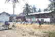
Playa de Oro
Playa de Oro gets its name from the gold that was once easily found here.
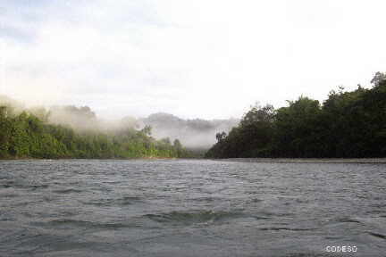
From Maldonado (half an hour from San Lorenzo) you embark in a canoe, going up the beautiful Santiago River for an hour and a half to reach Playa de Oro.
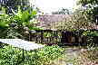
The black community of Playa de Oro has cute cabins for travelers. The cabins have electric light with solar energy and there is a cabin for meetings and dining.
The commune is located within the Cotacachi Cayapas Ecological Reserve, and is an ideal place where you can make different excursions, accompanied by the guides of the area.
To reach the community you have to communicate, the best way so far is to communicate with us, we make the contact and the preparations.
El Río Santiago frente a Playas de Oro
Playa de Oro
CI
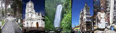
Other destinies, cities y sites
Quito - Guayaquil - Cuenca - Loja - Galapagos - San Cristobal - Ambato - Esmeraldas - Portoviejo - Guaranda
Vilcabamba - Mitad del Mundo - Ilinizas- Misahualli - Atacames - Baños - Otavalo - Chimborazo- Sangay


OTHER INTERESTING SITES
- The capital of the "Verde Esmeraldas Province". The city of Esmeraldas has an important maritime port and a small beach (within the city).
- San Lorenzo is 5 hours away by bus from Quito (passing through Ibarra), the same time is needed from Esmeraldas. The port of San Lorenzo is the point of shipment to Tumaco in Colombia. The Ibarra - San Lorenzo highway is new and in good condition.
- The town of Cauchal is located on an island inside the Mangrove Swamp in the Cayapas Mataje Mangrove Ecological Reserve. Cauchal beach is beautiful and lonely. By boat (small boat) it takes an hour and a half from San Lorenzo.
- Cotacachi is known for its leather crafts and its proximity to the Cotacachi Cayapas Ecological Reserve with the famous Cuycocha lagoon.
- Las Peñas beach is not as famous as the Atacames or Súa beaches, but it is much quieter and cheaper. From Esmeraldas it takes two and a half hours by bus, passing through San Mateo, Camarones and Río Verde. From San Lorenzo it takes two and a half hours by bus, going through Borbón.
- Beyond Las Peñas is La Tola, a small town, from where you can embark to visit La Tolita Island, famous for its Archaeological Park.
- Borbón is an hour away by bus from San Lorenzo.
Valdez - Limones
Río Santiago, Río Cayapas
- The Cayambe Coca Ecological Reserve is accessible from the city of Cayambe. The Reserve has a surface area of 403,103 ha including the Navado Cayambe.
- The Cotacachi Cayapas Ecological Reserve is accessible from the city of Cotacachi. The Reserve has a surface area of 204,420 ha.