Tourism in the Sangay Nacionalpark
Tourism in the Sangay Nacionalpark
Parque Nacional Sangay
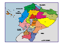
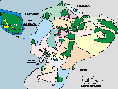
The Sangay National Park has an area of 517,765 hectares and was created on 06/16/1975.
Most of it is in the province of Morona Santiago, Chimborazo, Tungurahua and Cañar.
There are accesses from Riobamba, Baños and Puyo.
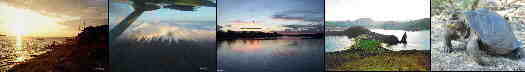
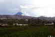
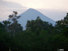
Within the Sangay National Park are the active volcanoes of Sangay (5230 m) and Tungurahua (5029m). Tugurahua is one of the most active volcanoes in Ecuador, it is 33 km from Ambato and close to Baños. El Sangay is 50 km southeast of Riobamba, it is one of the most continuously active volcanoes in the world.
Parque Nacional Sangay
CI
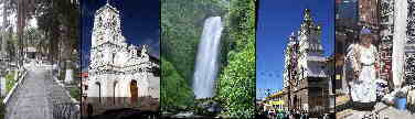
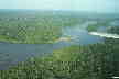
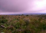
This park's main attractions are three volcanoes (two of them active), an infinity of lagoons with amazing stories, like the one where hundreds of birds come to die, and an enormous biodiversity. The park extends over the Eastern Cordillera protecting páramos, high Andean forests and subtropical forests. For all this wonderful geography and extraordinary biodiversity, in 1983 UNESCO declared it a World Heritage Site. In the park are the sources of the Upano, a river that borders the eastern city of Macas and then flows into the Pastaza towards the Amazon. The other important river is the Paute, which also marks the limit in the southeastern part; its dammed flow generates up to now the largest source of hydroelectricity for the country. The Paute then flows into the Santiago River in the Amazon.
The descendants of the Cañari and Puruhá peoples live in the mountainous and high part of the park, and in the jungle area are the territories of the Shuar nationality.

Other Natural o Protected Areas and Spots
Galapagos - Llanganates - Ilinizas - Chimborazo - Sangay - Yasuni - Cuyabeno - Machalilla - Cotopaxi


ACCESS SITES
- The city of Baños is the closest to the Tungurahua volcano, from there you can enter the Sangay National Park and climb the Tungurahua volcano.
- The city of Riobamba is also close to the Sangay National Park, from here many expeditions with guides leave.
- The city of Puyo is quite close to the Sangay National Park, from here expeditions with guides also leave.
- Es la capital de la provincia Morona Santiago en el sur amazonico.
Volcán Sangay
Volcán Tungurahua
Gran Sumaco Napo Province Protected Areas
Cotopaxi Highlands Paramo Protected Area
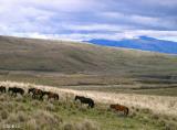
Horses Cotopaxi National Park
From Quito. It goes through the Panamericana Sur from Quito to Riobamba (194 km). From this city you can access several sites. Atillo. Take the road to San Luis until you reach the Guamote - Macas road that leads to the community of Atillo (74 km).
Ozogoche. Take the Panamericana Sur highway to the Charicando detour, in the Palmira area (64 km); From there, 35 kilometers are traveled on paved road along the road that leads to the "Y" of the Totoras community. Here you take a secondary road until you reach Ozogoche Alto.
The altar. Take the road to Penipe (22 km) and then continue along a secondary road until you reach the Candelaria parish where the checkpoint and entrance to the park is located.
Inca Trail. Take the Riobamba – El Tambo road. You can enter the trail from the town of Achupallas or from the Culebrillas lagoon (to get to this site, you start from the town of El Tambo).
Culebrillas Lagoon. Take the Panamericana Sur from the city of Riobamba up to 2 km before El Tambo. On the left is the entrance to Pillcopata
Fuente: areasprotegidas.ambiente.gob.ec